(Manila Comprehensive) The U.S. military is discussing with the Philippines to build a civilian port on the Batano Islands in the Basan Islands, the northernmost country in the Philippines.This will allow the US military to enter a strategic island near Taiwan, which is less than 200 kilometers from Taiwan.
The Basilica Strait is the main way of the Pacific and the South China Sea
The bus strait between Batness and Taiwan is the throat of the Western Pacific and the South China Sea.As the United States and China have intensified, and the United States is committed to strengthening the long -term defense treaty with the Philippines, this is expected to heat up the tension.
The Governor of the Badan Islands, Kaike Koko, told Reuters on Wednesday (August 30) that she had sought funds from the United States and built a "alternative port" at Basco Island to build a "alternative port" in orderWhen greater, help the ship from Manila unload.
According to the local government, ships often cannot enter and exit existing ports due to large waves.The Philippines may decide whether to build a new port in October.
The Philippine military is interested in deployment radar and raising monitoring
According to two anonymous Philippine officials, the U.S. military recently visited the Patan Islands province to discuss the issue of Hong Kong.One of the officials said that the Philippine military was interested in deploying radars in the local area and improving monitoring capabilities.
The US Embassy of the Philippines, Gogpadia, pointed out that the Embassy and the Pacific Army Command have contacted the Governor and local officials in the Badan Islands.He said that this was "to discuss how the United States supports Patan Province in terms of engineering, medicine and agriculture."
However, he did not mention the construction of a port on the Island of Bato.The Chinese Embassy in Manila did not immediately reply to the evaluation request.
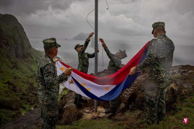
After the President of the Philippines, after coming to power, seeks more close relationships with the United States, and has recently opened more military bases for U.S. military use.
Recently, the Philippines and China have been tense in disputed in the South China Islands and Reefs.In addition to the Philippines, China, Vietnam, Malaysia and other countries have sovereign disputes in the South China Sea.
"2023 Edition China Standard Map" Factering Sands and Sand Sea Malaysia: Can't recognize
The Malaysian Ministry of Foreign Affairs issued a statement on Wednesday that the "2023 version of the Chinese Standard Map" of the Ministry of Natural Resources of China covers the waters of Sabah and Sarawak, and this sounds the South China Sea.The Malaysian government cannot recognize this approach, and related maps are not legal.
According to the statement, the Chinese standard map unilaterally puts the Sabah and Sarawak Water in the "Malaysia Latest Map" released by Malaysia in 1979, and is the sea area under the jurisdiction of China.
The statement emphasized that the Malaysian government adheres to the consistent claims of the South China Sea subject and the border of the sea area to protest the sovereignty or jurisdiction of any country to the Malaysian waters."The Malaysian government believes that the South China Sea subject is complex and sensitive. It must be in a peaceful and rational way to conduct dialogue and negotiations based on international laws such as the United Nations Marine Law Convention in 1982."