(Beijing / Taipei Comprehensive News) The super typhoon "Xuan Lannuo" entered the East China Sea, and there was huge waves in near the shore waters in Shanghai, Zhejiang and other places.
According to news from China News Agency and China Central Meteorological Observatory website, "Xuan Lannuo" Sunday (September 4) was strengthened to super typhoons again in the southern sea of the East China Sea at 11 am.During the day, it is located on the sea of Zhejiang and Shanghai, which will be the most serious period of impact on the East China Sea and near the shore waters.
As of 5 pm on the 4th, the center of "Xuan Lannuo" is located on the southeast of the southeast of Zhujiajian Island, Zhejiang Province. The largest wind near the center is 16 (52 meters per second).
At 6 pm on the 4th, the Central Meteorological Observatory continued to issue a yellow warning of the typhoon. It is expected that "Xuanlan Nuo" will move north at a speed of 15 to 20 kilometers per hour.The super typhoon level will go north on the 4th to 5th on the 4th to 5th; on the 5th, it will move to the northeast during the 5th, tending to the south of the Korean Peninsula to the Korean Strait.
The storm circle passes through the land of the northeast corner of Taiwan
The Central Meteorological Observatory predicts that there will be small to medium rain since the eastern and southern parts of Qinghai, southern Gansu, central and western Sichuan, Yunnan, Tibet, etc.Essence
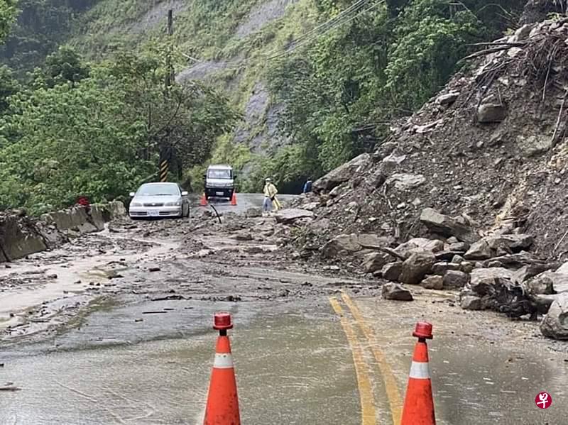
In addition, the "Xuanlan Nuo" storm circle gradually passed the land of the northeast of Taiwan on Saturday evening to noon on Sunday.There are local heavy rain or heavy rain in the mountains of Hsinchu County. Taipei City, New Taipei City, Taoyuan City and other regions have local heavy rain or heavy rain.There were more than 43,000 households in Taiwan on Sunday, and there were 402 disaster -related incidents. Among them, there were as many as 211 roads and trees collapse in Taipei and New Taipei City. Fortunately, no one was casualties.